活用イメージ

活用イメージ
弊社は自動3Dスキャナ『Hovermap』 を販売する代理店ではなく、 自社で運用して計測・解析・データ変換・BIM 化までを行う3D計測・データ提供の専門技術サービス会社 です。 現場で取得したスキャンデータをもとに、正確な点群情報や2D/3D モデルをお客様の目的に合わせて提供します。 つまり「機器を売る会社」ではなく、Hovermapの性能を最大限に活かし、現場の課題をデータで解決する会社です。
1~15 item / All 15 items
-

The benefits of visualizing factory spatial information and work procedures in 3D data.
/Explanation of Digital Twin/ Achieving a new work environment that "enhances human added value" through simulation × digital technology × AI!
last updated
-

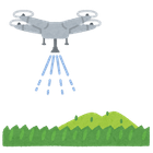
Manufacturing × Drones: For recording the current status of factory facilities and design support during equipment updates.
High-precision scanning in places where GPS is unavailable, such as indoors, underground, and behind structures, which were difficult to scan conventionally!
last updated
-

[Architecture and Civil Engineering × Drones] For recording structural scans and before-and-after seismic reinforcement design.
High-precision and high-quality 3D model generation is possible by combining with photogrammetry!
last updated
-

【Media and Video Production × Drone】Aerial Photography and Structure CG Generation
Scanning of high places, back surfaces, indoors, and underground is also possible, making it applicable to a wide range of industries and sites!
last updated
-

[Disaster Investigation and Insurance Assessment Company × Drone] Aerial Photography of Damage Sites from Typhoons, Earthquakes, etc.
Support for the creation of evidence documents that can be submitted to government agencies, insurance companies, etc., such as deterioration diagnosis and records before and after construction!
last updated
-

Building Management and FM × Drones: Visualization of Current Conditions in Tenant Buildings and Hospitals
Scanning of high places, back sides, indoors, and underground is also possible, making it applicable to a wide range of industries and sites!
last updated
-

[Robotics Trading Company × Drone] Facility Survey Before Introducing AGV/AMR
Support for the creation of evidence documents that can be submitted to government agencies, insurance companies, etc., such as deterioration diagnosis and records before and after construction!
last updated
-

Private Owners × Drones: Current Condition Acquisition of Warehouses, Stores, and Aging Facilities
Photorealistic 3D visualization using tools like Twinmotion enables support for consensus building among stakeholders, residents, and government!
last updated
-

[Urban Planning Operators × 3D Data Utilization] Acquisition of Current 3D Data for Redevelopment Areas, etc.
We possess the technical capability to operate drone aerial photography, Hovermap scanning, and photogrammetry as an integrated system, demonstrating high adaptability!
last updated
-

Infrastructure × Drones: For the diagnosis of aging bridges, tunnels, and water supply and sewage systems.
Three-dimensional structural understanding and digital archiving using a combination of aerial photography and scanning technology!
last updated
-

[Large Structures/Shipbuilding × Utilization of 3D Data] Measurement, Design, and Maintenance Support for Shipyards
3D data can be utilized throughout the entire lifecycle of the facility, contributing to long-term maintenance and asset management!
last updated
-

[Plant Engineering Company × Drone] Scanning of Complex Piping Structures
Scanning of high places, back surfaces, indoors, and underground is also possible, making it applicable to a wide range of industries and sites!
last updated
-

Electricity, gas, and communication infrastructure companies × drones: 3D recording of power plants, etc.
By non-contact scanning high places and dangerous areas with drones, it is possible to ensure both the safety of workers and the efficiency of surveying!
last updated
-

"Resource development, mining, geological survey company × drone" Scanning of mining sites, etc.
By non-contact scanning of high places and dangerous areas with drones, it is possible to ensure both the safety of workers and the efficiency of surveying!
last updated
-

Report on Laser Scan Results and Use Cases with Hovermap STX
An efficient data acquisition method utilizing advanced technology! Also introducing future directions.
last updated