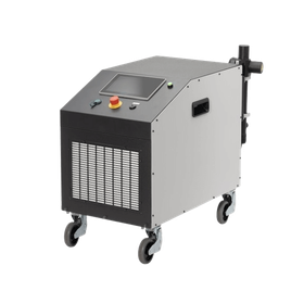
GVI-made handheld LiDAR LiGrip O2 Lite
Two high-definition cameras capture a wide area clearly, enabling multi-source data collection.
Using GreenValley International's proprietary algorithm, it is possible to estimate the self-location in forested areas where GNSS signals are weak (or unavailable), as well as within buildings and underground structures. We generate professional-level 3D point cloud data with high accuracy: absolute accuracy of 3cm, repeatability accuracy of 2cm, and relative accuracy of 2cm. Emphasizing portability and mobility, it can be carried and operated independently. (Weight: around 1kg)
basic information
System Parameters Absolute Accuracy: < 3 cm Relative Accuracy: < 2 cm Horizontal/Vertical: < 0.025° Power Supply Method: Lithium Battery Battery Capacity: 3450 mAh Battery Operating Time: 2 hours Weight: 1.3 kg IP Code: IP64 Storage Capacity: 512 GB SSD Ports: Type C Control Method: APP, Button Firmware Upgrade: OTA, Offline Operating Temperature: -20 ~ 40°C Device Storage Temperature: 40 ~ 70 °C Battery Storage Temperature: Recommended Storage Temperature: 22 °C ~ 30 °C LiDAR Sensor Parameters Sensor: Mid-360 Scan Rate: 200,000 pts/second LiDAR Accuracy: 2 cm Safety Level: Class 1 (Eye Safe) Laser Wavelength: 905 nm Detection Range 40 m @ 10% Reflectivity; 70 m @ 80% Reflectivity FOV Horizontal 360°, Vertical -7°~ 52° Camera Parameters Number of Cameras: 4 Visual Cameras: 1.3 MP x 2 Panorama Cameras: 12 MP x 2 Frame Rate: Adjustable
Price information
Please contact us.
Delivery Time
Model number/Brand name
LiGrip O2 Lite
Applications/Examples of results
Acquisition of point cloud data for terrain and structures, 3D mapping, spatial preservation, environmental sharing, VR/XR spaces, support for creating 3D Gaussian Splatting, and utilization for digital twins.
Detailed information
Related Videos
catalog(4)
Download All CatalogsRecommended products
Distributors
At Kōkyō, we aim to be a platform that connects researchers and engineers in the laser industry with manufacturers and trading companies. Through our operational sites "Optipedia" and "Optinews," as well as newsletters, we provide information dissemination and introduce carefully selected products from our extensive range of offerings. We also engage in the sale, rental, and subscription services of original optical products, as well as activities to promote optics and lasers.


